Page 1 of 2
Battle Maps and Elevations
Posted: Sun 13 Aug 2023, 15:27
by creativehum
First, I think the battle maps are lovely.
However, when I look at the maps I very uncertain where the boundaries of changing elevation come into play. Some contours are clear, but others are soft. Some shades make changes in elevation pronounced, while others (as far as I can tell) leave it ti my imagination to determine if that’s a third level of elevation, or some darker colored grass.
So, first, is anyone else having trouble reading the elevation on the maps?
Is there a key somewhere that might help me grasp how I am supposed to read them?
How many elevations are there?
Any other clues? How do others work with elevation in the game?
Re: Battle Maps and Elevations
Posted: Mon 14 Aug 2023, 01:33
by creativehum
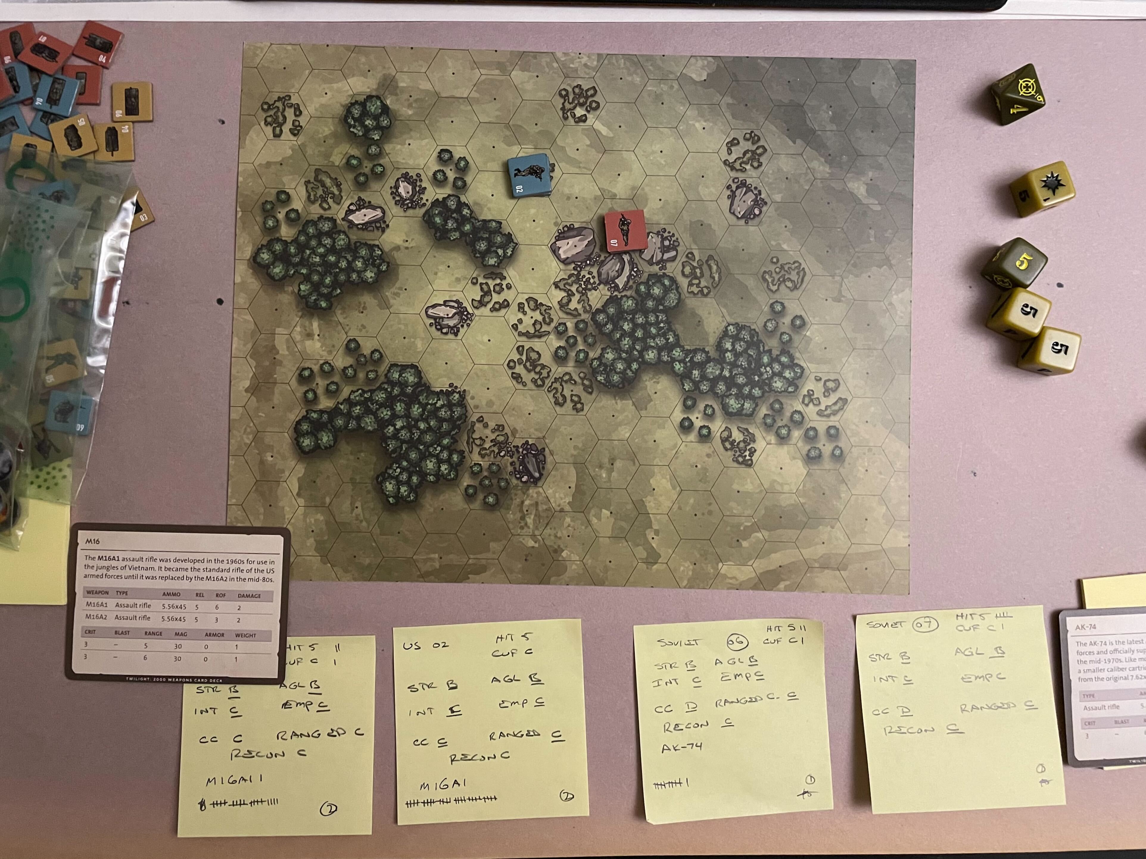
As an example, look at the map below. What is going on in the upper and lower corners of the right side of the map? I'm not saying it doesn't make sense. I'm asking: Can someone please help me make it make sense?
Thanks!
Re: Battle Maps and Elevations
Posted: Mon 14 Aug 2023, 08:41
by Vcutter
I don't think those are elevations. My take is that they are just artistic decisions to make the "grass/field" more varied to look at.
In general the polish and swedish countrysides are pretty flat overall.
And despite where your game takes place the area on the maps (150 m across or so) is so small that there probably won't be major changes in elevation.
Naturally those huge boulders and of course buildings provide the necessary elevation to play with high ground bonus and LoS arguments:D
Re: Battle Maps and Elevations
Posted: Fri 01 Sep 2023, 12:17
by Ursus Maior
I don't think those are elevations. My take is that they are just artistic decisions to make the "grass/field" more varied to look at.
In general the polish and swedish countrysides are pretty flat overall.
And despite where your game takes place the area on the maps (150 m across or so) is so small that there probably won't be major changes in elevation.
Naturally those huge boulders and of course buildings provide the necessary elevation to play with high ground bonus and LoS arguments:D
Could be artistic license, but it's clearly visible enough to mean something, too. I'd say the GM could use this to make elevations known to the player. Probably not much, but it could be a gently sloped hill. Maybe 1 m per hex in elevation?
Re: Battle Maps and Elevations
Posted: Wed 13 Sep 2023, 18:39
by baldrick0712
If you want to work with elevations here's a really elegant LOS method for when an intervening hex blocks LOS between a higher hex and a lower hex.
B = (H·X) / D
B is Blocked Hexes
H is Height of obstacle hex
X is Distance in hexes from obstacle to higher hex
D is Height difference (height of higher hex minus height of obstacle hex)
Example:
Soldier A is on a level 3 hill.
There's a level 2 obstacle 4 hexes from Soldier A (H = 2, X = 4, D = 1)
The obstacle therefore has 8 blind hexes behind it that Soldier A can't see (they are obscured by the obstacle).
Re: Battle Maps and Elevations
Posted: Wed 13 Sep 2023, 23:09
by paladin2019
Your formula needs to be H*X. As written, only 2.4 hexes are masked.
More importantly, without context as to the definition of "height," the formula becomes less valuable. How does the GM translate their conception of the battlefield to the players? How tall is an obstacle? Or a building?
Re: Battle Maps and Elevations
Posted: Wed 13 Sep 2023, 23:13
by Ash
Could be artistic license, but it's clearly visible enough to mean something, too. I'd say the GM could use this to make elevations known to the player. Probably not much, but it could be a gently sloped hill. Maybe 1 m per hex in elevation?
Purely artistic. Elevation is clearly indicated and follow hexes. There are some exceptions on urban maps, but then there are details (stairs/shadows) to help viewers get a clear idea of what is elevated terrain and what is not.
Re: Battle Maps and Elevations
Posted: Thu 14 Sep 2023, 10:16
by baldrick0712
Your formula needs to be H*X. As written, only 2.4 hexes are masked.
I was trying to imply HxX but put a dot to avoid confusion with the X variable. A dot can also mean multiply but think it should be higher (same level as crossbar in "H"). Apologies for any confusion.
[EDIT] Fixed (used
·)
Re: Battle Maps and Elevations
Posted: Thu 14 Sep 2023, 10:23
by baldrick0712
More importantly, without context as to the definition of "height," the formula becomes less valuable. How does the GM translate their conception of the battlefield to the players? How tall is an obstacle? Or a building?
Typically in wargames 1 level is about the height of a single-story building. If you want it to be less than this you would have to factor in posture (someone standing has less blind hexes than someone crouching).
[EDIT] The formula doesn't care about units. Level 1 could be 5m or 10m and it would still work.
Re: Battle Maps and Elevations
Posted: Thu 14 Sep 2023, 11:32
by paladin2019
Height is vitally important. Just because you can't see the ground doesn't mean you can't see the hex. Without knowing how the observer's height interacts with the definition of a level, you can't know where their sight line begins. Without knowing how the interesting thing's(TM) height interacts with the definition of a level, you can't know where it is visible, only where the ground is visible.
I haven't seen a typical wargame height outside of "true line of sight." Every game I play that doesn't do this uses a different definition. But let's assume "one story building." A standing person would be visible 6 hexes out, and potentially 5 if exceptionally tall for some reason. Kneeling and crouching figures are visible at 7. If we adjust for observer height, the ranges get closer. At "one story," a standing observer adds at least half a level (other profiles add less, natch), potentially allowing the ground to be seen as close as 5 hexes, while a combat vehicle might add a full level. If a level has a different definition, these factors change.